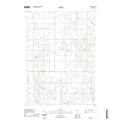
2019 Map of Trufant
USGS Topo · Published 2019About this map
Trufant sits at the heart of this landscape, surrounded by an intricate network of glacial lakes and wetlands that define the border of Montcalm County and Kent County. The geography is characterized by numerous small bodies of water such as Maston Lake, Lincoln Lake, and Rainbow Lake, many of which are connected by complex waterways like the Lovett and Cody Drain. The southern portion of the area is drained by the Flat River, which flows near the settlement of Gowen.
Find a feature on this map
113 named features on this map. Tap any name to fly to it.
Don’t see what you’re looking for? This feature index may not catch every label — zoom into the map to look around manually.
Map Details
Editions of this 2019 Trufant Map
This is the sole edition of this map. No revisions or reprints were ever made.
Other maps of this area

1954 · Midland
USGS Topo · 1:250,000

1958 · Midland
USGS Topo · 1:250,000

1959 · Midland
USGS Topo · 1:250,000

1959 · Howard City
USGS Topo · 1:62,500

1964 · Six Lakes
USGS Topo · 1:24,000

1964 · Langston
USGS Topo · 1:24,000

1966 · Midland
USGS Topo · 1:250,000

1972 · Greenville West
USGS Topo · 1:24,000
1972 · Greenville East
USGS Topo · 1:24,000
1972 · Evans
USGS Topo · 1:24,000