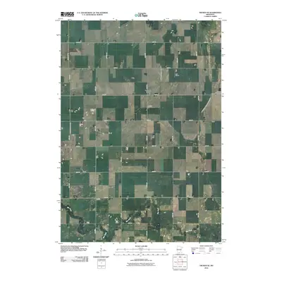
2010 Map of Truman SE
USGS Topo · Published 2010About this map
Nashville Center stands as the primary community hub in this portion of Martin County, where the agricultural landscape is defined by a rigorous grid of section roads and water management infrastructure. The area's history of land cultivation and drainage is etched into the terrain through features such as Judicial Ditch Number Eightythree and Judicial Ditch Number Nine, which channel water toward the winding course of Elm Creek in the south. For those researching local lineages, the Nashville Cemetery and the more distantly placed Pleasant Prairie Basey Cemetery provide critical geographic markers for early settlers. The small-scale aviation of Burk Airport serves as a modern landmark amidst the expansive fields of southern Minnesota.
Find a feature on this map
27 named features on this map. Tap any name to fly to it.
Don’t see what you’re looking for? This feature index may not catch every label — zoom into the map to look around manually.
Map Details
Editions of this 2010 Truman SE Map
This is the sole edition of this map. No revisions or reprints were ever made.
Other maps of this area

1954 · Fairmont
USGS Topo · 1:250,000

1958 · Fairmont
USGS Topo · 1:250,000

1967 · Truman
USGS Topo · 1:24,000

1967 · Truman SE
USGS Topo · 1:24,000

1967 · Winnebago
USGS Topo · 1:24,000

1967 · Willow Creek
USGS Topo · 1:24,000

1967 · Lewisville
USGS Topo · 1:24,000

1967 · Granada
USGS Topo · 1:24,000

1967 · Huntley
USGS Topo · 1:24,000
1967 · Amboy
USGS Topo · 1:24,000