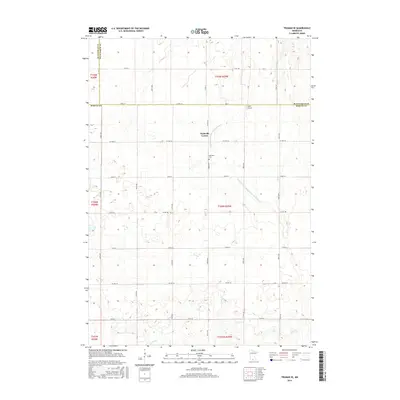
2016 Map of Truman SE
USGS Topo · Published 2016About this map
Nashville Center serves as the focal point of this agricultural landscape in southern Minnesota, situated near the intersection of Co HWY 52 and Co HWY 57. The map illustrates a highly managed hydrologic system, where natural watercourses like Elm Cr are supplemented by an extensive network of drainage infrastructure, including Judicial Ditch Number Eightythree and Judicial Ditch Number One Hundred Six. These features reflect the region's long-standing commitment to land reclamation for farming. Local history and genealogy interest is anchored by the Nashville Cem and the small Burk Airport located near the county line. The map also delineates the precise meeting of Martin, Blue Earth, and Watonwan counties, providing a clear view of the rural township and range system at the start of the 21st century.
Find a feature on this map
40 named features on this map. Tap any name to fly to it.
Don’t see what you’re looking for? This feature index may not catch every label — zoom into the map to look around manually.
Map Details
Editions of this 2016 Truman SE Map
This is the sole edition of this map. No revisions or reprints were ever made.
Other maps of this area

1954 · Fairmont
USGS Topo · 1:250,000

1958 · Fairmont
USGS Topo · 1:250,000

1967 · Truman
USGS Topo · 1:24,000

1967 · Truman SE
USGS Topo · 1:24,000

1967 · Winnebago
USGS Topo · 1:24,000

1967 · Willow Creek
USGS Topo · 1:24,000

1967 · Lewisville
USGS Topo · 1:24,000

1967 · Granada
USGS Topo · 1:24,000

1967 · Huntley
USGS Topo · 1:24,000
1967 · Amboy
USGS Topo · 1:24,000