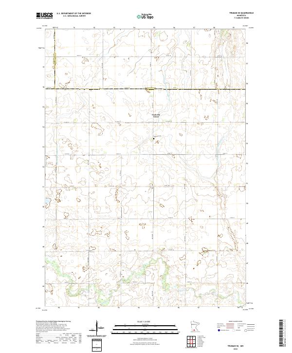
2022 Map of Truman SE
USGS Topo · Published 2022About this map
Nashville Center serves as a focal point for this agrarian section of southern Minnesota, situated near the intersection of several township lines and county borders. The landscape is defined by its extensive water management systems, including Judicial Ditch Number Eightythree, Judicial Ditch Number Nine, and Judicial Ditch Number One Hundred Six, which crisscross the square sections typical of the Public Land Survey System. These man-made channels support the agricultural productivity of the region, eventually feeding into the natural course of Elm Cr in the southern portion of the map. Genealogists and local historians can locate the Nashville Cem, a significant landmark for the families that settled the surrounding Martin and Blue Earth counties. The grid-like road network, featuring routes such as Co HWY 52 and Co HWY 57, underscores the organized development of the rural prairie into a structured farming community.
Find a feature on this map
42 named features on this map. Tap any name to fly to it.
Don’t see what you’re looking for? This feature index may not catch every label — zoom into the map to look around manually.
Map Details
Editions of this 2022 Truman SE Map
This is the sole edition of this map. No revisions or reprints were ever made.
Other maps of this area

1954 · Fairmont
USGS Topo · 1:250,000

1958 · Fairmont
USGS Topo · 1:250,000

1967 · Truman
USGS Topo · 1:24,000

1967 · Truman SE
USGS Topo · 1:24,000

1967 · Winnebago
USGS Topo · 1:24,000

1967 · Willow Creek
USGS Topo · 1:24,000

1967 · Lewisville
USGS Topo · 1:24,000

1967 · Granada
USGS Topo · 1:24,000

1967 · Huntley
USGS Topo · 1:24,000
1967 · Amboy
USGS Topo · 1:24,000