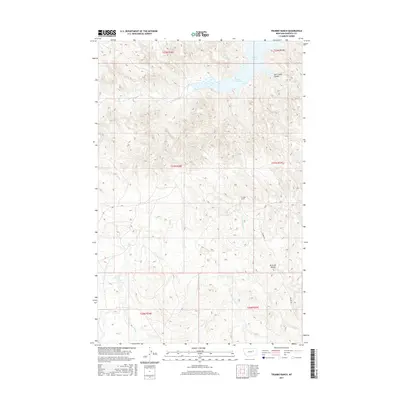
2017 Map of Trumbo Ranch
USGS Topo · Published 2017About this map
Trumbo Ranch serves as a focal point in this sparsely settled region of Garfield County, where the high plains of eastern Montana meet the intricate shoreline of Fort Peck Lake. The landscape is defined by deep drainages such as East Cabin Coulee and Snow Cr, which cut through the high ground toward Snow Creek Bay. This 2017 survey details the complex system of coulees and creeks including Hell Cr and Cottonwood Cr, illustrating how the Missouri River reservoir has reshaped the local geography. Human presence is light, concentrated around the eponymous ranch and the winding path of Trumbo Rd. Landmarks like Brownie Butte provide navigational reference points across the breaks, while the map's contour lines reveal the significant elevation changes between the upland plateaus and the water's edge.
Find a feature on this map
15 named features on this map. Tap any name to fly to it.
Don’t see what you’re looking for? This feature index may not catch every label — zoom into the map to look around manually.
Map Details
Editions of this 2017 Trumbo Ranch Map
This is the sole edition of this map. No revisions or reprints were ever made.
Other maps of this area

1954 · Jordan
USGS Topo · 1:250,000

1956 · Jordan
USGS Topo · 1:250,000

1958 · Jordan
USGS Topo · 1:250,000

1958 · Maloney Hill
USGS Topo · 1:62,500

1964 · Jordan
USGS Topo · 1:250,000

1964 · Jordan NW
USGS Topo · 1:24,000

1971 · Hell Hollow
USGS Topo · 1:24,000

1971 · Trumbo Ranch
USGS Topo · 1:24,000

1971 · Wagon Coulee
USGS Topo · 1:24,000

1971 · Harper Camp
USGS Topo · 1:24,000