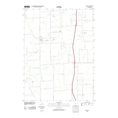
2010 Map of Truro
USGS Topo · Published 2010About this map
Truro serves as the primary hub in this Madison County landscape, where the Truro Post Office anchors a grid of rural routes. The surrounding terrain is defined by a dendritic network of waterways, most notably the South River, which is joined by tributaries like Broadhorn Creek, Hanner Creek, and Walnut Creek. These streams carve through a predominantly agricultural region, evidenced by landmarks like South River Field.
Find a feature on this map
61 named features on this map. Tap any name to fly to it.
Don’t see what you’re looking for? This feature index may not catch every label — zoom into the map to look around manually.
Map Details
Editions of this 2010 Truro Map
This is the sole edition of this map. No revisions or reprints were ever made.
Other maps of this area

1931 · Indianola
USGS Topo · 1:62,500

1950 · New Virginia
USGS Topo · 1:62,500

1951 · Osceola
USGS Topo · 1:62,500

1951 · St. Charles
USGS Topo · 1:62,500

1952 · New Virginia
USGS Topo · 1:62,500

1954 · Des Moines
USGS Topo · 1:250,000

1956 · Des Moines
USGS Topo · 1:250,000

1957 · Des Moines
USGS Topo · 1:250,000

1969 · Des Moines
USGS Topo · 1:250,000
1983 · St. Charles
USGS Topo · 1:24,000