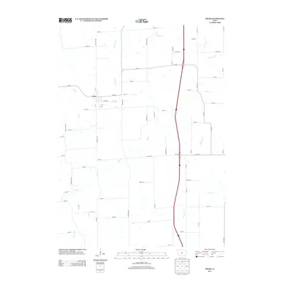
2013 Map of Truro
USGS Topo · Published 2013About this map
Truro serves as the central hub of this agricultural landscape, where a grid of local roads and named avenues intersects the natural drainage of the South Central Iowa terrain. The community's residential layout is defined by streets such as E Prairie Rd and 2nd St, while the surrounding countryside is deeply etched by the winding path of the S River and its numerous tributaries. These watercourses, including Broadhorn Cr and Limestone Cr, create a dendritic drainage pattern that dictates the placement of rural routes like Peru Rd and Settlers Trl. The map illustrates a modern infrastructure overlay on a traditional farming region, characterized by long-established section-line roads and more recent developments like the Interstate 35 corridor passing through the eastern half of the quadrangle.
Find a feature on this map
67 named features on this map. Tap any name to fly to it.
Don’t see what you’re looking for? This feature index may not catch every label — zoom into the map to look around manually.
Map Details
Editions of this 2013 Truro Map
This is the sole edition of this map. No revisions or reprints were ever made.
Other maps of this area

1931 · Indianola
USGS Topo · 1:62,500

1950 · New Virginia
USGS Topo · 1:62,500

1951 · Osceola
USGS Topo · 1:62,500

1951 · St. Charles
USGS Topo · 1:62,500

1952 · New Virginia
USGS Topo · 1:62,500

1954 · Des Moines
USGS Topo · 1:250,000

1956 · Des Moines
USGS Topo · 1:250,000

1957 · Des Moines
USGS Topo · 1:250,000

1969 · Des Moines
USGS Topo · 1:250,000
1983 · St. Charles
USGS Topo · 1:24,000