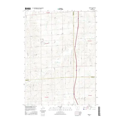
2015 Map of Truro
USGS Topo · Published 2015About this map
Truro serves as the central hub of this Iowa landscape, where the town’s grid is centered around its Po and essential local streets like Prairie St and 1st St. The surrounding countryside is defined by a dense network of watercourses and family-named landmarks that speak to generations of settlement. The South River and its various tributaries, including Broadhorn Cr, Walnut Cr, and Limestone Cr, cut through the terrain, creating a complex drainage system that has influenced farm layouts and road placements for decades. Genealogists will find this map particularly valuable for its documentation of rural burial sites, including Farson Cem, Worthing Cem, Young Cem, Hartman Cem, Field Cem, and Fremont Cem. These sites, often positioned on high ground away from the creek beds of Hay Br or Hanner Cr, remain as some of the most enduring markers of the early families who established these townships.
Find a feature on this map
63 named features on this map. Tap any name to fly to it.
Don’t see what you’re looking for? This feature index may not catch every label — zoom into the map to look around manually.
Map Details
Editions of this 2015 Truro Map
This is the sole edition of this map. No revisions or reprints were ever made.
Other maps of this area

1931 · Indianola
USGS Topo · 1:62,500

1950 · New Virginia
USGS Topo · 1:62,500

1951 · Osceola
USGS Topo · 1:62,500

1951 · St. Charles
USGS Topo · 1:62,500

1952 · New Virginia
USGS Topo · 1:62,500

1954 · Des Moines
USGS Topo · 1:250,000

1956 · Des Moines
USGS Topo · 1:250,000

1957 · Des Moines
USGS Topo · 1:250,000

1969 · Des Moines
USGS Topo · 1:250,000
1983 · St. Charles
USGS Topo · 1:24,000