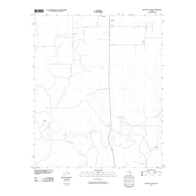
2010 Map of Truscott South
USGS Topo · Published 2010About this map
The South Wichita River meanders across this rural section of Knox County, defining a landscape of ranching and remote agriculture. To the north, the small settlement of Truscott sits near the Truscott Cemetery, a vital waypoint for genealogists tracing families in the Rolling Plains region. The terrain is marked by seasonal drainages like Sheep Creek and Deadman Creek, which feed into the primary river valley. Ranching legacy is evident through named landmarks such as Beavers Ranch and Glover Bend along the river's curves. The road network, including Todd Ranch Rd and Ranch Rd, reflects the sparse but intentional layout of large-scale landholdings. This survey captures the region's enduring character, where water sources like China Lake and China Creek have long dictated the patterns of human settlement and movement.
Find a feature on this map
18 named features on this map. Tap any name to fly to it.
Don’t see what you’re looking for? This feature index may not catch every label — zoom into the map to look around manually.
Map Details
Editions of this 2010 Truscott South Map
This is the sole edition of this map. No revisions or reprints were ever made.
Other maps of this area

1954 · Wichita Falls
USGS Topo · 1:250,000

1958 · Wichita Falls
USGS Topo · 1:250,000

1966 · Truscott North
USGS Topo · 1:24,000

1966 · Truscott South
USGS Topo · 1:24,000

1966 · Halsell Ranch
USGS Topo · 1:24,000

1966 · Gilliland
USGS Topo · 1:24,000

1966 · Big Four Ranch
USGS Topo · 1:24,000

1966 · Maverick Flat
USGS Topo · 1:24,000

1967 · Cedar Mountain
USGS Topo · 1:24,000

1967 · Benjamin
USGS Topo · 1:24,000