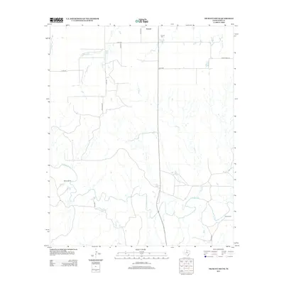
2013 Map of Truscott South
USGS Topo · Published 2013About this map
The S Wichita River meanders across the southern portion of this Knox County landscape, creating a distinctive geography marked by Glover Bend. In the northern section, the small community of Truscott serves as a local focal point, supported by the nearby Truscott Cem and a network of rural roads such as Todd Ranch Rd and S Floyd Ave. This 2013 survey illustrates the ranching and agricultural character of North Texas, where water sources like China Lake, China Cr, and Sheep Cr are critical landmarks. Farther south, Beavers Ranch sits near the river, while Deadman Cr cuts through the northeast corner. The map documents a sparse, open territory defined by its creek systems and family-named ranch lands, providing a clear view of the regional infrastructure in the early 21st century.
Find a feature on this map
19 named features on this map. Tap any name to fly to it.
Don’t see what you’re looking for? This feature index may not catch every label — zoom into the map to look around manually.
Map Details
Editions of this 2013 Truscott South Map
This is the sole edition of this map. No revisions or reprints were ever made.
Other maps of this area

1954 · Wichita Falls
USGS Topo · 1:250,000

1958 · Wichita Falls
USGS Topo · 1:250,000

1966 · Truscott North
USGS Topo · 1:24,000

1966 · Truscott South
USGS Topo · 1:24,000

1966 · Halsell Ranch
USGS Topo · 1:24,000

1966 · Gilliland
USGS Topo · 1:24,000

1966 · Big Four Ranch
USGS Topo · 1:24,000

1966 · Maverick Flat
USGS Topo · 1:24,000

1967 · Cedar Mountain
USGS Topo · 1:24,000

1967 · Benjamin
USGS Topo · 1:24,000