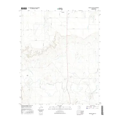
2016 Map of Truscott South
USGS Topo · Published 2016About this map
The South Wichita River meanders through the southern portion of this Knox County landscape, creating the prominent Glover Bend and defining the local topography. North of the river, the small settlement of Truscott serves as a focal point for the surrounding ranching and agricultural lands. Evidence of long-standing community roots can be found at the Truscott Cem, while the hydrological character of the region is shaped by several drainage systems, including China Cr, Sheep Cr, and Deadman Cr.
Find a feature on this map
21 named features on this map. Tap any name to fly to it.
Don’t see what you’re looking for? This feature index may not catch every label — zoom into the map to look around manually.
Map Details
Editions of this 2016 Truscott South Map
This is the sole edition of this map. No revisions or reprints were ever made.
Other maps of this area

1954 · Wichita Falls
USGS Topo · 1:250,000

1958 · Wichita Falls
USGS Topo · 1:250,000

1966 · Truscott North
USGS Topo · 1:24,000

1966 · Truscott South
USGS Topo · 1:24,000

1966 · Halsell Ranch
USGS Topo · 1:24,000

1966 · Gilliland
USGS Topo · 1:24,000

1966 · Big Four Ranch
USGS Topo · 1:24,000

1966 · Maverick Flat
USGS Topo · 1:24,000

1967 · Cedar Mountain
USGS Topo · 1:24,000

1967 · Benjamin
USGS Topo · 1:24,000