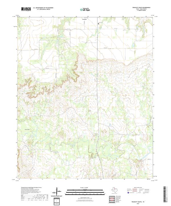
2022 Map of Truscott South
USGS Topo · Published 2022About this map
South Wichita River carves a sinuous path through the southern half of this Knox County landscape, defining the local geography alongside major drainage systems like Sheep Cr and Deadman Cr. The map is centered on the rural ranching and farming lands south of Truscott, where a grid of county roads such as Co RD 2500 and Todd Ranch Rd provides access to large tracts of territory. A notable local landmark is Glover Bend, a significant meander in the river that highlights the area's hydrology.
Find a feature on this map
20 named features on this map. Tap any name to fly to it.
Don’t see what you’re looking for? This feature index may not catch every label — zoom into the map to look around manually.
Map Details
Editions of this 2022 Truscott South Map
This is the sole edition of this map. No revisions or reprints were ever made.
Other maps of this area

1954 · Wichita Falls
USGS Topo · 1:250,000

1958 · Wichita Falls
USGS Topo · 1:250,000

1966 · Truscott North
USGS Topo · 1:24,000

1966 · Truscott South
USGS Topo · 1:24,000

1966 · Halsell Ranch
USGS Topo · 1:24,000

1966 · Gilliland
USGS Topo · 1:24,000

1966 · Big Four Ranch
USGS Topo · 1:24,000

1966 · Maverick Flat
USGS Topo · 1:24,000

1967 · Cedar Mountain
USGS Topo · 1:24,000

1967 · Benjamin
USGS Topo · 1:24,000