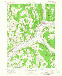
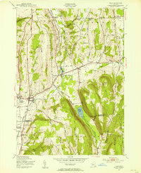
1955 Map of Truxton
USGS Topo · Published 1966About this map
Tioughnioga River and its meandering tributaries dominate this mid-century portrait of northeastern Cortland County. The valley floor serves as a vital corridor for both the Lehigh Valley railroad and local commerce, connecting settlements like Truxton and East Homer through the East Branch Valley Road. Uplands are defined by significant public land holdings, including several numbered State Reforestation Areas and the N Y State College of Forestry grounds near the Tully Forest Line. Local life is anchored by traditional landmarks such as the East Homer Sch and St Patricks Cem. The mapping of small hamlets like Crains Mills and East River reveals a landscape transitioning from historical milling and agrarian foundations to modern conservation and reforestation efforts during the 1950s.
Find a feature on this map
38 named features on this map. Tap any name to fly to it.
Don’t see what you’re looking for? This feature index may not catch every label — zoom into the map to look around manually.
Map Details
Editions of this 1955 Truxton Map
4 editions found
Other maps of this area

1897 · Cazenovia
USGS Topo · 1:62,500

1899 · Cazenovia
USGS Topo · 1:62,500

1900 · Tully
USGS Topo · 1:62,500

1903 · Cortland
USGS Topo · 1:62,500

1904 · Pitcher
USGS Topo · 1:62,500

1943 · Otisco Valley
USGS Topo · 1:31,680
1943 · Tully
USGS Topo · 1:24,000

1943 · De Ruyter
USGS Topo · 1:24,000

1943 · Cincinnatus
USGS Topo · 1:24,000

1943 · Cuyler
USGS Topo · 1:24,000