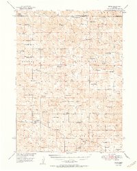
1951 Map of Tryon
USGS Topo · Published 1951About this map
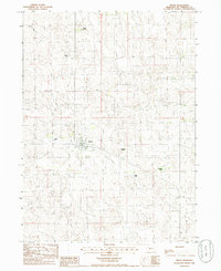
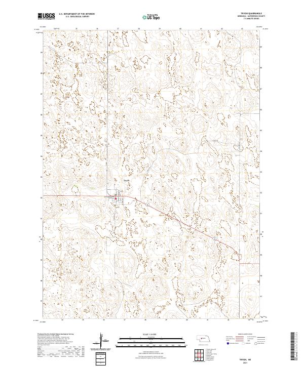
Tryon serves as the central hub of this Nebraska Sandhills landscape, recorded just after the mid-century during the Missouri River Basin development program. The topography is defined by the sweeping Worden Hall Valley, where a network of family-held cattle operations like the McClintock Ranch, Jameson Ranch, and Nilsen Ranch anchor the local economy. This era shows a high density of rural infrastructure, with numerous numbered schoolhouses such as School No 24 and School No 48 spaced across the range to serve isolated ranching families. The map also captures the ecclesiastical and social presence of Miller Ch, highlighting the spiritual life of this remote community. The boundary lines between Hooker, McPherson, and Thomas counties intersect here, reflecting the political geography of a region where land use and livestock remain the primary drivers of settlement patterns.
Find a feature on this map
50 named features on this map. Tap any name to fly to it.
Don’t see what you’re looking for? This feature index may not catch every label — zoom into the map to look around manually.
Map Details
Editions of this 1951 Tryon Map
2 editions found
Historical Maps of Tryon Through Time
6 maps found