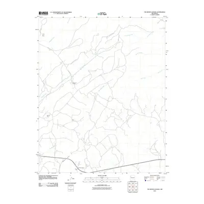
2010 Map of Tse Bonita School
USGS Topo · Published 2010About this map
Industrial activity and high-desert drainage patterns define this region near the New Mexico and Arizona border. The landscape is marked by significant resource extraction sites, including the McKinley Mine, Window Rock Coal Mine, and Gando Coal, illustrating the area's importance to the regional energy economy. These operations sit amidst a complex network of ephemeral waterways such as Coal Mine Wash, Slick Rock Wash, and Tse Bonita Wash, which carve through the arid terrain toward Defiance Draw. The settlement of Black Hat and the Tse Bonita School serve as local focal points along the southern transit corridor. Further north, the terrain rises toward Slick Rock and is accessed by several specialized routes, including White Face Mountain Rd and the utilitarian Logging Road 8010, reflecting a landscape managed for both mineral and timber resources.
Find a feature on this map
20 named features on this map. Tap any name to fly to it.
Don’t see what you’re looking for? This feature index may not catch every label — zoom into the map to look around manually.
Map Details
Editions of this 2010 Tse Bonita School Map
This is the sole edition of this map. No revisions or reprints were ever made.
Other maps of this area

1886 · Wingate
USGS Topo · 1:250,000

1886 · Fort Defiance
USGS Topo · 1:250,000

1892 · Fort Defiance
USGS Topo · 1:250,000

1892 · Wingate
USGS Topo · 1:250,000

1954 · Gallup
USGS Topo · 1:250,000

1955 · Zith-Tusayan Butte 4 NE
USGS Topo · 1:24,000

1955 · Zith-Tusayan Butte 1 SE
USGS Topo · 1:24,000

1955 · Tohatchi
USGS Topo · 1:62,500
1955 · Buell Park
USGS Topo · 1:62,500

1958 · Gallup
USGS Topo · 1:250,000