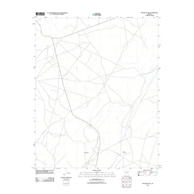
2011 Map of Tsin Naan Tee
USGS Topo · Published 2011About this map
Tsin Naan Tee and the surrounding high desert terrain are defined by a complex network of local routes and natural landmarks in the Fort Defiance Agency region. The landscape is punctuated by White Point, a prominent terrain feature that overlooks a web of desert roads including Indian Rte 6751 and Indian Rte 9256. This 2011 survey illustrates the modern transportation infrastructure of the area, showing how major arteries like Indian Rte 9000 and Indian Rte 9061 converge near the settlement. The sparse distribution of named features emphasizes the importance of these specific locations and travel corridors for navigation across the open expanses of this part of Arizona.
Find a feature on this map
6 named features on this map. Tap any name to fly to it.
Don’t see what you’re looking for? This feature index may not catch every label — zoom into the map to look around manually.
Map Details
Editions of this 2011 Tsin Naan Tee Map
This is the sole edition of this map. No revisions or reprints were ever made.
Other maps of this area

1883 · Tusayan
USGS Topo · 1:250,000

1886 · Tusayan
USGS Topo · 1:250,000

1886 · Fort Defiance
USGS Topo · 1:250,000

1892 · Fort Defiance
USGS Topo · 1:250,000

1947 · Flagstaff
USGS Topo · 1:250,000

1954 · Flagstaff
USGS Topo · 1:250,000

1954 · Gallup
USGS Topo · 1:250,000

1958 · Gallup
USGS Topo · 1:250,000

1958 · Flagstaff
USGS Topo · 1:250,000

1959 · Gallup
USGS Topo · 1:250,000