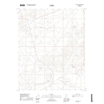
2018 Map of Tsin Naan Tee
USGS Topo · Published 2018About this map
Tsin Naan Tee and the surrounding high desert of the Navajo Nation are documented in this 2018 survey by the U.S. Geological Survey. The landscape is characterized by its significant elevation changes, particularly around the prominent topographic feature known as White Point. This region, located within the Fort Defiance Agency, displays a network of tribal roads including Indian Rte 9000, Indian Rte 9061, and Indian Rte 9156 that connect disparate homesteads and seasonal grazing areas. The map provides a contemporary view of the intersection between traditional land use and modern infrastructure near the boundary of Navajo Co, illustrating how contemporary transit routes follow the natural contours of the plateau terrain.
Find a feature on this map
10 named features on this map. Tap any name to fly to it.
Don’t see what you’re looking for? This feature index may not catch every label — zoom into the map to look around manually.
Map Details
Editions of this 2018 Tsin Naan Tee Map
This is the sole edition of this map. No revisions or reprints were ever made.
Other maps of this area

1883 · Tusayan
USGS Topo · 1:250,000

1886 · Tusayan
USGS Topo · 1:250,000

1886 · Fort Defiance
USGS Topo · 1:250,000

1892 · Fort Defiance
USGS Topo · 1:250,000

1947 · Flagstaff
USGS Topo · 1:250,000

1954 · Flagstaff
USGS Topo · 1:250,000

1954 · Gallup
USGS Topo · 1:250,000

1958 · Gallup
USGS Topo · 1:250,000

1958 · Flagstaff
USGS Topo · 1:250,000

1959 · Gallup
USGS Topo · 1:250,000