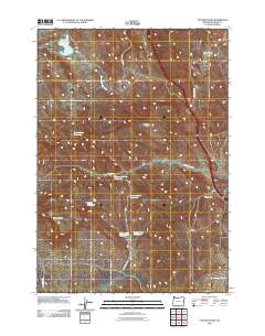
2011 Map of Tub Mountain
USGS Topo · Published 2011About this map
Tub Mountain stands as a central landmark in this high-desert stretch of Malheur County, where the landscape is defined by an intricate network of drainage basins and water storage. The area is marked by numerous catchments, including Love Reservoir, Moores Hollow Reservoir, and the Alkali Reservoir, reflecting the essential nature of water management in this arid Oregon territory. Navigational history is etched into the terrain via the Old Oregon Trl in the southwest corner, while modern transit is dominated by the highway corridor running through the eastern half of the quadrangle. The topography alternates between significant ridges like Pine Tree Ridge and deep erosional features such as Wheel Gulch Basin and Trail Gulch, illustrating the geologic character of the region as it appeared in the early 21st century.
Find a feature on this map
21 named features on this map. Tap any name to fly to it.
Don’t see what you’re looking for? This feature index may not catch every label — zoom into the map to look around manually.
Map Details
Editions of this 2011 Tub Mountain Map
This is the sole edition of this map. No revisions or reprints were ever made.
Other maps of this area

1950 · Jamieson
USGS Topo · 1:62,500

1951 · Moores Hollow
USGS Topo · 1:24,000

1951 · Malheur Butte
USGS Topo · 1:24,000

1951 · Moores Hollow
USGS Topo · 1:62,500

1951 · Huntington
USGS Topo · 1:62,500

1952 · Olds Ferry
USGS Topo · 1:24,000

1952 · Olds Ferry
USGS Topo · 1:62,500

1952 · Olds Ferry SE
USGS Topo · 1:24,000

1955 · Baker
USGS Topo · 1:250,000

1959 · Baker
USGS Topo · 1:250,000