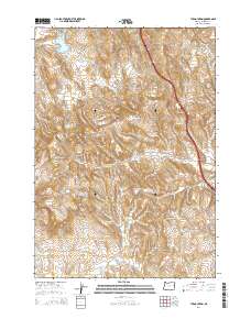
2014 Map of Tub Mountain
USGS Topo · Published 2014About this map
Tub Mountain and the surrounding high desert of Malheur County define this landscape of arid ridges and vital water catchments. The terrain is characterized by a network of seasonal drainages and man-made impoundments such as Love Reservoir, Bostic Lake Reservoir, and Alkali Flat Reservoir, which are essential for managing water in this dry environment. The presence of Tub Springs near the mountain itself highlights the historical importance of natural water sources for travelers and livestock in the region.
Find a feature on this map
28 named features on this map. Tap any name to fly to it.
Don’t see what you’re looking for? This feature index may not catch every label — zoom into the map to look around manually.
Map Details
Editions of this 2014 Tub Mountain Map
This is the sole edition of this map. No revisions or reprints were ever made.
Other maps of this area

1950 · Jamieson
USGS Topo · 1:62,500

1951 · Moores Hollow
USGS Topo · 1:24,000

1951 · Malheur Butte
USGS Topo · 1:24,000

1951 · Moores Hollow
USGS Topo · 1:62,500

1951 · Huntington
USGS Topo · 1:62,500

1952 · Olds Ferry
USGS Topo · 1:24,000

1952 · Olds Ferry
USGS Topo · 1:62,500

1952 · Olds Ferry SE
USGS Topo · 1:24,000

1955 · Baker
USGS Topo · 1:250,000

1959 · Baker
USGS Topo · 1:250,000