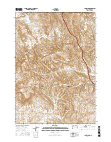
2017 Map of Tub Mountain
USGS Topo · Published 2017About this map
Tub Mountain and the surrounding high desert of eastern Oregon define this landscape, where water management is central to the local geography. The map documents an extensive network of small reservoirs and catchment basins, including Love Reservoir, Bostic Lake Reservoir, and the cluster of Alkali Reservoir, Alkali Gulch Reservoir, and Alkali Flat Reservoir. These features, along with Tub Springs, indicate a terrain where water is a precious resource for ranching and land use.
Find a feature on this map
26 named features on this map. Tap any name to fly to it.
Don’t see what you’re looking for? This feature index may not catch every label — zoom into the map to look around manually.
Map Details
Editions of this 2017 Tub Mountain Map
This is the sole edition of this map. No revisions or reprints were ever made.
Other maps of this area

1950 · Jamieson
USGS Topo · 1:62,500

1951 · Moores Hollow
USGS Topo · 1:24,000

1951 · Malheur Butte
USGS Topo · 1:24,000

1951 · Moores Hollow
USGS Topo · 1:62,500

1951 · Huntington
USGS Topo · 1:62,500

1952 · Olds Ferry
USGS Topo · 1:24,000

1952 · Olds Ferry
USGS Topo · 1:62,500

1952 · Olds Ferry SE
USGS Topo · 1:24,000

1955 · Baker
USGS Topo · 1:250,000

1959 · Baker
USGS Topo · 1:250,000