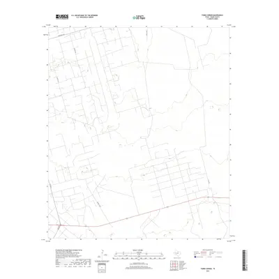
2019 Map of Tubbs Corner
USGS Topo · Published 2019About this map
Industrial and ranching infrastructure defines this high plains landscape in Crane County. The layout of Exxon Loop and Barnsley Loop reflects the extensive development of oil and gas fields, with a dense network of local access roads supporting extraction efforts. This modern 2019 survey shows the intersection of energy production and traditional land use, where long-distance routes like Ranch Rd 1233 and Fm 1053 N cut across the arid terrain. The geometry of the road system suggests a highly managed landscape, serving both the energy industry and the sprawling ranch properties common to this part of West Texas. Notable named corridors such as Katie Lea Rd and Pj Lea Rd provide specialized access into the interior of the quadrangle, which remains largely open territory punctuated by service roads and industrial pads.
Find a feature on this map
7 named features on this map. Tap any name to fly to it.
Don’t see what you’re looking for? This feature index may not catch every label — zoom into the map to look around manually.
Map Details
Editions of this 2019 Tubbs Corner Map
This is the sole edition of this map. No revisions or reprints were ever made.
Other maps of this area

1928 · Crane
USGS Topo · 1:125,000

1954 · Pecos
USGS Topo · 1:250,000

1957 · Pecos
USGS Topo · 1:250,000

1964 · Doodle Bug Well
USGS Topo · 1:24,000

1964 · Penwell SW
USGS Topo · 1:24,000

1964 · Penwell SE
USGS Topo · 1:24,000

1974 · Tubbs Corner
USGS Topo · 1:24,000

1974 · Crane SW
USGS Topo · 1:24,000

1974 · Juan Cordona Lake
USGS Topo · 1:24,000
1974 · Crane NW
USGS Topo · 1:24,000