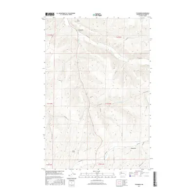
2017 Map of Tucannon
USGS Topo · Published 2017About this map
Tucannon River flows northwest through the high plateaus of Washington, anchoring a landscape defined by deep drainages and rural corridors. The small settlements of Tucannon and Whetstone serve as key landmarks within this system of valleys, where agricultural and ranching life centers around water sources like Willow Cr and Whetstone Cr. The map reveals a network of roads named for local families and geographic features, such as Brines Rd, Poulsen Rd, and Smith Hollow Rd, which navigate the steep transition between the canyon floor and the surrounding uplands. Local history and genealogy researchers will find interest in the early transportation routes, including the Territorial Rd, and the distinct natural landforms like Dry Hollow and Smith Hollow that have long shaped the settlement patterns and livestock movements in this part of Columbia County.
Find a feature on this map
30 named features on this map. Tap any name to fly to it.
Don’t see what you’re looking for? This feature index may not catch every label — zoom into the map to look around manually.
Map Details
Editions of this 2017 Tucannon Map
This is the sole edition of this map. No revisions or reprints were ever made.
Other maps of this area

1919 · Walla Walla
USGS Topo · 1:125,000

1921 · Walla Walla
USGS Topo · 1:125,000

1937 · Pomeroy
USGS Topo · 1:96,000

1942 · Pomeroy
USGS Topo · 1:125,000

1948 · Starbuck
USGS Topo · 1:62,500

1950 · Starbuck
USGS Topo · 1:62,500

1950 · Hay
USGS Topo · 1:62,500

1952 · Hay
USGS Topo · 1:62,500

1953 · Walla Walla
USGS Topo · 1:250,000

1955 · Pullman
USGS Topo · 1:250,000