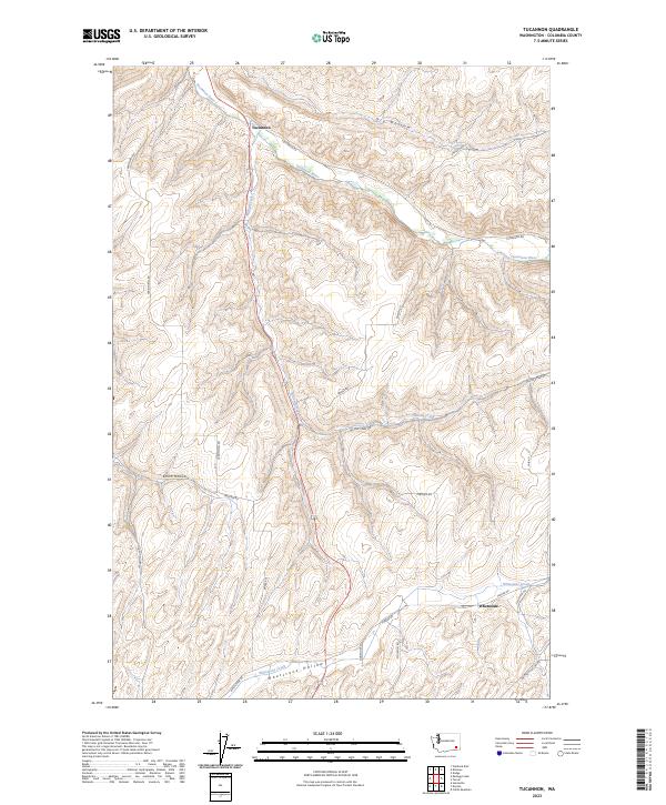
2023 Map of Tucannon
USGS Topo · Published 2023About this map
Tucannon River cuts a deep valley through the high plateau of Columbia County, where the small community of Tucannon serves as a focal point for the surrounding canyon landscape. The drainage patterns of Willow Creek and Whetstone Creek define the local topography, carving out significant landforms like Dry Hollow and Smith Hollow. This area shows a persistent reliance on a rural road network established along natural contours and section lines, with routes such as Territorial Rd and Tucannon Rd connecting remote homesteads and agricultural tracts. In the southern portion of the map, the settlement of Whetstone sits near Whetstone Hollow, highlighting the historical importance of water access in this high-elevation region of southeastern Washington. The landscape remains primarily defined by its hydrology and the early territorial road system that still dictates movement through the hills today.
Find a feature on this map
31 named features on this map. Tap any name to fly to it.
Don’t see what you’re looking for? This feature index may not catch every label — zoom into the map to look around manually.
Map Details
Editions of this 2023 Tucannon Map
This is the sole edition of this map. No revisions or reprints were ever made.
Other maps of this area

1919 · Walla Walla
USGS Topo · 1:125,000

1921 · Walla Walla
USGS Topo · 1:125,000

1937 · Pomeroy
USGS Topo · 1:96,000

1942 · Pomeroy
USGS Topo · 1:125,000

1948 · Starbuck
USGS Topo · 1:62,500

1950 · Starbuck
USGS Topo · 1:62,500

1950 · Hay
USGS Topo · 1:62,500

1952 · Hay
USGS Topo · 1:62,500

1953 · Walla Walla
USGS Topo · 1:250,000

1955 · Pullman
USGS Topo · 1:250,000