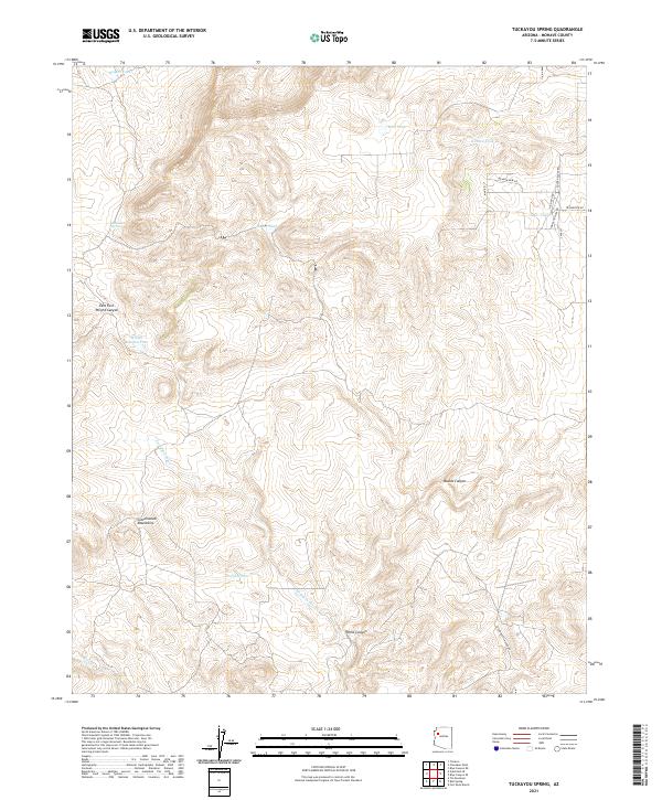
2021 Map of Tuckayou Spring
USGS Topo · Published 2021About this map
The Cottonwood Mountains dominate this high-desert landscape in Mohave County, where water management is the primary marker of human presence. Modern infrastructure like Orejana Dam and a network of livestock watering points such as Hodges Tank, Hazen Tank, and Oakes Tank illustrate the region's ranching heritage. The terrain is defined by deep cuts into the plateau, including the dramatic Hells Canyon and Munds Canyon, which channel seasonal runoff toward Tuckayou Wash. While much of the area remains undeveloped rangeland, a pocket of residential naming appears in the northeast corner with Meadowview DR and Ridgeview RD. These road names and the presence of Limestone Spring provide concrete landmarks for researchers tracing contemporary land use and topographic change in this arid corner of Arizona.
Find a feature on this map
27 named features on this map. Tap any name to fly to it.
Don’t see what you’re looking for? This feature index may not catch every label — zoom into the map to look around manually.
Map Details
Editions of this 2021 Tuckayou Spring Map
This is the sole edition of this map. No revisions or reprints were ever made.
Other maps of this area

1886 · Diamond Creek
USGS Topo · 1:250,000

1892 · Diamond Creek
USGS Topo · 1:250,000

1948 · Williams
USGS Topo · 1:250,000

1954 · Williams
USGS Topo · 1:250,000

1956 · Williams
USGS Topo · 1:250,000

1960 · Williams
USGS Topo · 1:250,000

1961 · Williams
USGS Topo · 1:250,000
1968 · Truxton
USGS Topo · 1:24,000
1968 · Tin Mountain
USGS Topo · 1:24,000
1968 · Valentine SE
USGS Topo · 1:24,000