
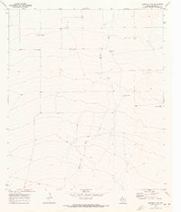
1970 Map of Tucker Hill
USGS Topo · Published 1973About this map
Hackberry Draw carves a path through the arid landscape of West Texas, defining the local topography between the Reeves Co Pecos Co line. In the early 1970s, this area was characterized by a scattered network of resource extraction and ranching infrastructure. Named elevations like Tucker Hill and Hayter Hill rise above a plain dotted with family-named or section-marked water sources, including the Riggs Windmill, Metzger Windmill, and York Windmill. The presence of a dedicated Schoolhouse and a Roadside Park suggests a community structure oriented around the highway and local ranching interests. Along Mendel Road and the main thoroughfare, several Gravel Pits, a Gas Well, and an Oil Well indicate the industrial footprint of the era, while fine red dashed lines on the survey trace the extensive fence lines of the surrounding estates.
Find a feature on this map
19 named features on this map. Tap any name to fly to it.
Don’t see what you’re looking for? This feature index may not catch every label — zoom into the map to look around manually.
Map Details
Editions of this 1970 Tucker Hill Map
This is the sole edition of this map. No revisions or reprints were ever made.
Other maps of this area

1929 · Hovey
USGS Topo · 1:125,000

1931 · Barstow
USGS Topo · 1:125,000

1954 · Pecos
USGS Topo · 1:250,000

1954 · Fort Stockton
USGS Topo · 1:250,000

1957 · Pecos
USGS Topo · 1:250,000

1958 · Fort Stockton
USGS Topo · 1:250,000

1970 · Belding SW
USGS Topo · 1:24,000

1970 · Deep Well Ranch
USGS Topo · 1:24,000
1970 · Barstow 3 SW
USGS Topo · 1:24,000

1970 · Deep Well Ranch SE
USGS Topo · 1:24,000