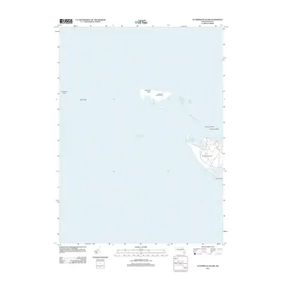
2012 Map of Tuckernuck Island
USGS Topo · Published 2012About this map
Tuckernuck Island and the neighboring Muskeget Island appear in this survey of a shifting coastal landscape west of Nantucket. The map reveals the intricate network of roads on the eastern end of Tuckernuck Island, encircling North Pond and stretching toward the narrow sands of Smith Point. To the west, the tiny Muskeget Island Airport is noted on its namesake landmass, surrounded by the shoals of Bass Ledge and Muskeget Rock. This 2012 snapshot captures the fragile relationship between the Atlantic Ocean and these low-lying landforms, highlighting the complex underwater topography of Tuckernuck Bank that defines the navigation in these waters.
Find a feature on this map
9 named features on this map. Tap any name to fly to it.
Don’t see what you’re looking for? This feature index may not catch every label — zoom into the map to look around manually.
Map Details
Editions of this 2012 Tuckernuck Island Map
This is the sole edition of this map. No revisions or reprints were ever made.
Other maps of this area

1887 · Muskeget
USGS Topo · 1:62,500

1889 · Muskeget
USGS Topo · 1:62,500

1893 · Muskeget
USGS Topo · 1:62,500

1899 · Muskeget
USGS Topo · 1:62,500

1942 · Nantucket
USGS Topo · 1:125,000

1944 · Tuckernuck Island
USGS Topo · 1:31,680

1947 · Providence
USGS Topo · 1:250,000

1948 · Providence
USGS Topo · 1:250,000
1951 · Tuckernuck Island
USGS Topo · 1:31,680

1957 · Providence
USGS Topo · 1:250,000