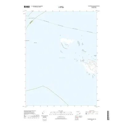
2018 Map of Tuckernuck Island
USGS Topo · Published 2018About this map
The maritime environment of the Atlantic Ocean dominates this coastal survey, where the administrative boundary between Dukes Co and Nantucket Co cuts through the open water. The map traces the essential transit route of the Oak Bluffs - Nantucket Ferry, a vital link for the island communities. Landform details are focused on the shifting shoals and small land masses that define the region, including the sheltered North Pond on the eastern edge of the sheet. The survey provides a clear look at the navigational hazards and landmarks known to local mariners, such as Muskeget Rock, Bass Ledge, and the shallow reaches of Tuckernuck Bank. This 2018 edition uses modern imagery and hydrography to document the fragile shoreline and the persistence of traditional ferry lanes.
Find a feature on this map
7 named features on this map. Tap any name to fly to it.
Don’t see what you’re looking for? This feature index may not catch every label — zoom into the map to look around manually.
Map Details
Editions of this 2018 Tuckernuck Island Map
This is the sole edition of this map. No revisions or reprints were ever made.
Other maps of this area

1887 · Muskeget
USGS Topo · 1:62,500

1889 · Muskeget
USGS Topo · 1:62,500

1893 · Muskeget
USGS Topo · 1:62,500

1899 · Muskeget
USGS Topo · 1:62,500

1942 · Nantucket
USGS Topo · 1:125,000

1944 · Tuckernuck Island
USGS Topo · 1:31,680

1947 · Providence
USGS Topo · 1:250,000

1948 · Providence
USGS Topo · 1:250,000
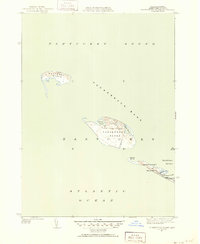
1951 · Tuckernuck Island
USGS Topo · 1:31,680

1957 · Providence
USGS Topo · 1:250,000