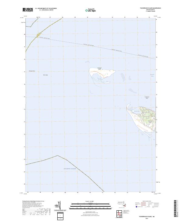
2024 Map of Tuckernuck Island
USGS Topo · Published 2024About this map
Tuckernuck Island and Muskeget Island anchor this coastal survey, where the shifting sands of the Atlantic meet Nantucket Sound. The landscape is dominated by low-lying maritime environments, featuring the interior North Pond on Tuckernuck and a series of surrounding shoals and hazards including Bass Ledge and Muskeget Rock. The isolation of these landmasses is emphasized by the expansive open water and the long transit of the Oak Bluffs - Nantucket Ferry crossing the northern section of the sheet. Tracing the boundary between Dukes Co and Nantucket Co, the map reveals the complex hydrography of the Tuckernuck Bank, illustrating how the sea constantly reshapes the outer edges of the Massachusetts coast.
Find a feature on this map
10 named features on this map. Tap any name to fly to it.
Don’t see what you’re looking for? This feature index may not catch every label — zoom into the map to look around manually.
Map Details
Editions of this 2024 Tuckernuck Island Map
This is the sole edition of this map. No revisions or reprints were ever made.
Other maps of this area

1887 · Muskeget
USGS Topo · 1:62,500

1889 · Muskeget
USGS Topo · 1:62,500

1893 · Muskeget
USGS Topo · 1:62,500

1899 · Muskeget
USGS Topo · 1:62,500

1942 · Nantucket
USGS Topo · 1:125,000

1944 · Tuckernuck Island
USGS Topo · 1:31,680

1947 · Providence
USGS Topo · 1:250,000

1948 · Providence
USGS Topo · 1:250,000
1951 · Tuckernuck Island
USGS Topo · 1:31,680

1957 · Providence
USGS Topo · 1:250,000