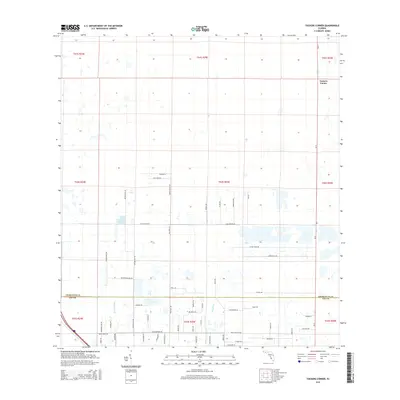
2015 Map of Tuckers Corner
USGS Topo · Published 2015About this map
Tuckers Corner serves as the focal point for this section of Southwest Florida, situated along the SR-31 corridor near the boundary of Charlotte and Lee Counties. The landscape is defined by a sparse grid of rural roads and drainage features, with the waters of Popash Cr and Daughtrey Cr winding through the southern reaches of the survey. The mapping reveals a transition toward organized land development and large-lot agricultural parcels, indicated by the network of named secondary roads like Nalle Grade Rd and Cook Brown Rd.
Find a feature on this map
58 named features on this map. Tap any name to fly to it.
Don’t see what you’re looking for? This feature index may not catch every label — zoom into the map to look around manually.
Map Details
Editions of this 2015 Tuckers Corner Map
This is the sole edition of this map. No revisions or reprints were ever made.
Other maps of this area

1956 · Telegraph Swamp
USGS Topo · 1:24,000

1956 · Cleveland
USGS Topo · 1:24,000

1956 · Telegraph Swamp NW
USGS Topo · 1:24,000

1956 · Bermont
USGS Topo · 1:24,000

1956 · West Palm Beach
USGS Topo · 1:250,000

1957 · West Palm Beach
USGS Topo · 1:250,000

1957 · Tuckers Corner
USGS Topo · 1:24,000

1957 · Gilchrist
USGS Topo · 1:24,000

1958 · West Palm Beach
USGS Topo · 1:250,000

1958 · Fort Myers NW
USGS Topo · 1:24,000