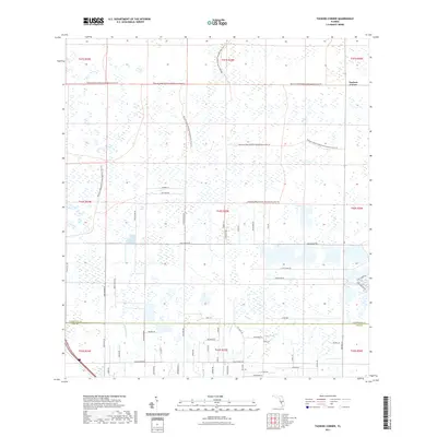
2021 Map of Tuckers Corner
USGS Topo · Published 2021About this map
The Babcock Webb Wildlife Management Area Trl dominates the northern and central portions of this landscape, marking a vast expanse of wetlands and preserved land. In the northeast, the small settlement of Tuckers Corner sits at the intersection of rural routes, while the southern half of the sheet shows more frequent development along the Charlotte Co Lee Co line. Waterways including Daughtrey Cr and Popash Cr drain the low-lying terrain, which is gridded by a series of long rural roads such as Cook Brown Rd and Nalle Grade Rd. The emergence of modern subdivisions is visible in the southeast near Lake Babcock Dr and Lake Timber Dr, showing the transition from wild marshland and ranches like Perry Ranch Rd to planned residential communities.
Find a feature on this map
57 named features on this map. Tap any name to fly to it.
Don’t see what you’re looking for? This feature index may not catch every label — zoom into the map to look around manually.
Map Details
Editions of this 2021 Tuckers Corner Map
This is the sole edition of this map. No revisions or reprints were ever made.
Other maps of this area

1956 · Telegraph Swamp
USGS Topo · 1:24,000

1956 · Cleveland
USGS Topo · 1:24,000

1956 · Telegraph Swamp NW
USGS Topo · 1:24,000

1956 · Bermont
USGS Topo · 1:24,000

1956 · West Palm Beach
USGS Topo · 1:250,000

1957 · West Palm Beach
USGS Topo · 1:250,000

1957 · Tuckers Corner
USGS Topo · 1:24,000

1957 · Gilchrist
USGS Topo · 1:24,000

1958 · West Palm Beach
USGS Topo · 1:250,000

1958 · Fort Myers NW
USGS Topo · 1:24,000