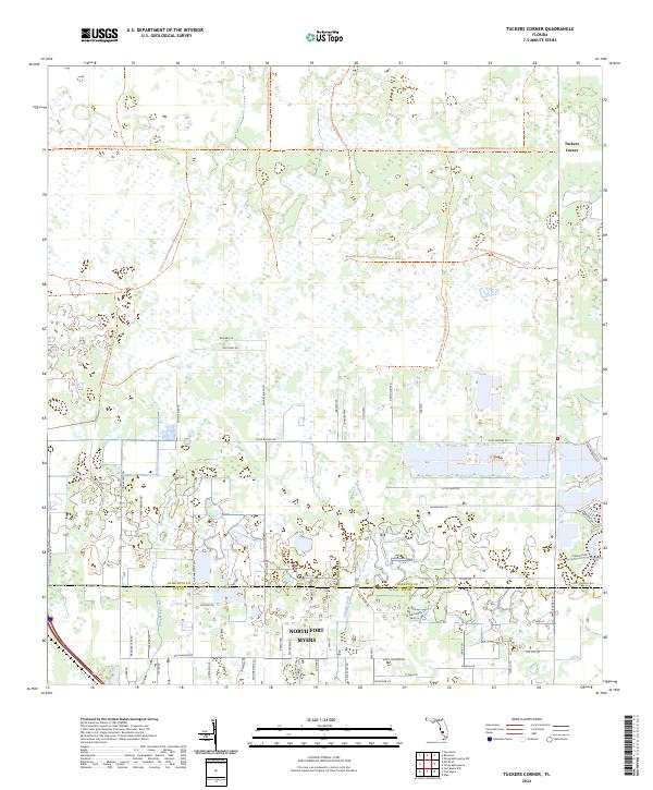
2024 Map of Tuckers Corner
USGS Topo · Published 2024About this map
Babcock Webb Wildlife Management Area Trl dominates the northern landscape of this region, crossing the township lines of the t41s r25e and t42s r25e districts. This area, located near the Charlotte and Lee County line, exhibits a transition from protected wetlands and wildlife corridors to the northern suburban fringes of North Fort Myers. The network of small roads such as Old Farm Rd, Perry Ranch Rd, and Little Farm Rd suggests a history of rural land use and ranching that persists alongside newer developments. Waterways like Daughtrey Creek and Popash Creek drain this low-lying terrain, which is characterized by numerous small ponds and wetland pockets. The settlement at Tuckers Corner serves as a local landmark in a landscape increasingly defined by modern infrastructure like Cypress Pkwy and residential streets like Suzan Dr and Lariat Ln.
Find a feature on this map
65 named features on this map. Tap any name to fly to it.
Don’t see what you’re looking for? This feature index may not catch every label — zoom into the map to look around manually.
Map Details
Editions of this 2024 Tuckers Corner Map
This is the sole edition of this map. No revisions or reprints were ever made.
Other maps of this area

1956 · Telegraph Swamp
USGS Topo · 1:24,000

1956 · Cleveland
USGS Topo · 1:24,000

1956 · Telegraph Swamp NW
USGS Topo · 1:24,000

1956 · Bermont
USGS Topo · 1:24,000

1956 · West Palm Beach
USGS Topo · 1:250,000

1957 · West Palm Beach
USGS Topo · 1:250,000

1957 · Tuckers Corner
USGS Topo · 1:24,000

1957 · Gilchrist
USGS Topo · 1:24,000

1958 · West Palm Beach
USGS Topo · 1:250,000

1958 · Fort Myers NW
USGS Topo · 1:24,000