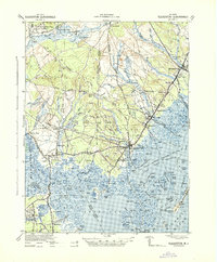
1942 Map of Tuckerton
USGS Topo · Published 1942About this map
Little Egg Harbor and its intricate network of coastal sedges, channels, and inlets define this Jersey Shore landscape during the early 1940s. The bustling center of Tuckerton is flanked by smaller settlements like Nugentown and Giffordtown, while the inland pine barrens are marked by historical industry at Stafford Forge. The survey highlights a complex water-based economy and transport system, from the Little Egg Inland Waterway to the remote reaches of the Oswego River.
Find a feature on this map
132 named features on this map. Tap any name to fly to it.
Don’t see what you’re looking for? This feature index may not catch every label — zoom into the map to look around manually.
Map Details
Editions of this 1942 Tuckerton Map
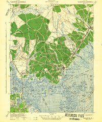
2 editions found
Other maps of this area

1884 · Whitings
USGS Topo · 1:62,500

1887 · Atlantic City
USGS Topo · 1:62,500

1888 · Pemberton
USGS Topo · 1:62,500

1888 · Barnegat
USGS Topo · 1:62,500

1888 · Little Egg Harbor
USGS Topo · 1:62,500

1888 · Long Beach
USGS Topo · 1:62,500

1888 · Whitings
USGS Topo · 1:62,500

1890 · Great Egg Harbor
USGS Topo · 1:62,500

1890 · Mullica
USGS Topo · 1:62,500

1893 · Great Egg Harbor
USGS Topo · 1:62,500
Featured Places
- Galloway Township, NJ
- Stafford Township, NJ
- Barnegat Township, NJ
- Little Egg Harbor Township, NJ
- Tuckerton, NJ