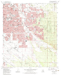
1983 Map of Tucson East
USGS Topo · Published 1983About this map
Davis-Monthan Air Force Base dominates the southern landscape of this Arizona quadrangle, creating a distinct boundary between the expanding urban grid of Tucson and the open desert terrain. The residential blocks to the north are densely packed with civic institutions, including Santa Rita HS, Palo Verde HS, and numerous elementary schools such as Booth Sch and Erickson School. The map captures a moment when the suburban expansion is meeting the natural drainage systems of Pantano Wash and Tanque Verde Wash.
Find a feature on this map
72 named features on this map. Tap any name to fly to it.
Don’t see what you’re looking for? This feature index may not catch every label — zoom into the map to look around manually.
Map Details
Editions of this 1983 Tucson East Map
2 editions found
Other maps of this area

1904 · Tucson
USGS Topo · 1:125,000

1905 · Tucson
USGS Topo · 1:125,000

1948 · Tucson
USGS Topo · 1:62,500

1956 · Tucson
USGS Topo · 1:250,000

1957 · Tucson East
USGS Topo · 1:24,000

1957 · Bellota Ranch
USGS Topo · 1:62,500

1957 · Tucson
USGS Topo · 1:24,000

1957 · Tucson
USGS Topo · 1:62,500

1957 · Rincon Valley
USGS Topo · 1:62,500

1957 · Sabino Canyon
USGS Topo · 1:24,000