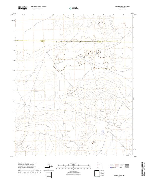
2023 Map of Tucson Spring
USGS Topo · Published 2023About this map
Tucson Spring provides a vital water source in this arid high-desert landscape situated along the border of Socorro Co and Sierra Co. This 2023 survey by the U.S. Geological Survey illustrates the spare, open geography of the region, where topographic contours define a series of subtle rises and drainage basins. Human activity is evidenced primarily by an established road network, most notably the path of Naval Site Rd which enters the southwestern portion of the map. The minimal infrastructure and lack of named settlements reflect a preserved wilderness or government-managed territory, characteristic of the remote expanses between New Mexico's larger population centers.
Find a feature on this map
3 named features on this map. Tap any name to fly to it.
Don’t see what you’re looking for? This feature index may not catch every label — zoom into the map to look around manually.
Map Details
Editions of this 2023 Tucson Spring Map
This is the sole edition of this map. No revisions or reprints were ever made.
Other maps of this area

1916 · Salinas Peak
USGS Topo · 1:125,000

1948 · Val Verde
USGS Topo · 1:62,500

1948 · Malpais Well
USGS Topo · 1:62,500

1954 · Tularosa
USGS Topo · 1:250,000

1958 · Tularosa
USGS Topo · 1:250,000

1961 · Paraje Well
USGS Topo · 1:24,000

1961 · Crocker
USGS Topo · 1:24,000

1961 · Lava
USGS Topo · 1:24,000

1979 · Truth or Consequences
USGS Topo · 1:100,000

1979 · San Mateo Mountains
USGS Topo · 1:100,000