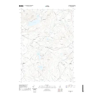
2021 Map of Tuftonboro
USGS Topo · Published 2021About this map
Water Village and Center Tuftonboro anchor this 2021 topographic survey of a landscape defined by significant elevation changes and numerous glacial water bodies. The terrain rises sharply to the north and west toward the Ossipee Mountains, including peaks such as Sentinel Mtn and Canaan Mtn. The drainage patterns are clearly defined by the Melvin River and Beech River, which connect a series of significant ponds including Dan Hole Pond and the vertically separated Upper Beech Pond and Lower Beech Pond.
Find a feature on this map
108 named features on this map. Tap any name to fly to it.
Don’t see what you’re looking for? This feature index may not catch every label — zoom into the map to look around manually.
Map Details
Editions of this 2021 Tuftonboro Map
This is the sole edition of this map. No revisions or reprints were ever made.
Other maps of this area

1909 · Winnepesaukee
USGS Topo · 1:62,500

1928 · Wolfeboro
USGS Topo · 1:62,500

1930 · Ossipee Lake
USGS Topo · 1:62,500

1931 · Mt. Chocorua
USGS Topo · 1:62,500

1949 · Portland
USGS Topo · 1:250,000

1956 · Winnipesaukee
USGS Topo · 1:62,500

1956 · Portland
USGS Topo · 1:250,000

1958 · Ossipee Lake
USGS Topo · 1:62,500

1958 · Wolfeboro
USGS Topo · 1:62,500

1958 · Mt. Chocorua
USGS Topo · 1:62,500