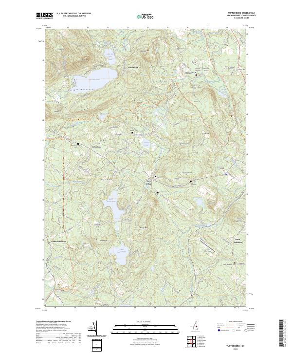
2024 Map of Tuftonboro
USGS Topo · Published 2024About this map
Ossipee Mountains dominate the northwestern landscape of this Carroll County region, where the terrain transitions from steep peaks like Sentinel Mtn to the clustered ponds of the central valley. Small settlements including Tuftonboro, Water Village, and Chickville are connected by a network of local roads that weave around significant water bodies such as Dan Hole Pond and Lower Beech Pond. The presence of the Carroll County Courthouse near the eastern edge suggests a civic hub, while the Chickville Airport highlights the area's modern infrastructure.
Find a feature on this map
123 named features on this map. Tap any name to fly to it.
Don’t see what you’re looking for? This feature index may not catch every label — zoom into the map to look around manually.
Map Details
Editions of this 2024 Tuftonboro Map
This is the sole edition of this map. No revisions or reprints were ever made.
Other maps of this area

1909 · Winnepesaukee
USGS Topo · 1:62,500

1928 · Wolfeboro
USGS Topo · 1:62,500

1930 · Ossipee Lake
USGS Topo · 1:62,500

1931 · Mt. Chocorua
USGS Topo · 1:62,500

1949 · Portland
USGS Topo · 1:250,000

1956 · Winnipesaukee
USGS Topo · 1:62,500

1956 · Portland
USGS Topo · 1:250,000

1958 · Ossipee Lake
USGS Topo · 1:62,500

1958 · Wolfeboro
USGS Topo · 1:62,500

1958 · Mt. Chocorua
USGS Topo · 1:62,500