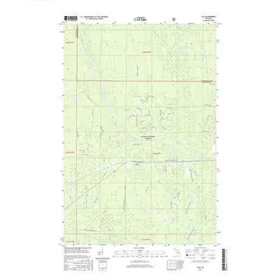
2017 Map of Tula
USGS Topo · Published 2017About this map
Tula sits as a quiet node within the expansive Ottawa National Forest, straddling the border between Ontonagon and Gogebic counties. This mid-2010s survey captures a landscape defined by its waterways and forest management infrastructure. The Presque Isle River winds through the terrain, punctuated by natural features like Nimikon Falls and Minnewawa Falls. The road network is largely comprised of specialized routes such as Underwood Tower Rd and Jack Spur Rd, reflecting the area's timber and conservation history. Evidence of the region's evolution is found in Old M 28, while the Bessemer Snowmobile #8 trail indicates the modern recreational use of the forest. The presence of the Canoe-Presque Isle River label further highlights the importance of these waterways for navigation and outdoor heritage in the Upper Peninsula.
Find a feature on this map
67 named features on this map. Tap any name to fly to it.
Don’t see what you’re looking for? This feature index may not catch every label — zoom into the map to look around manually.
Map Details
Editions of this 2017 Tula Map
This is the sole edition of this map. No revisions or reprints were ever made.
Other maps of this area

1955 · Marenisco
USGS Topo · 1:62,500

1955 · Marenisco
USGS Topo · 1:24,000

1955 · Wakefield
USGS Topo · 1:24,000

1955 · Wakefield
USGS Topo · 1:62,500

1955 · Wakefield NE
USGS Topo · 1:24,000

1956 · Bergland
USGS Topo · 1:62,500

1956 · Thomaston
USGS Topo · 1:62,500

1958 · Iron River
USGS Topo · 1:250,000

1960 · Iron River
USGS Topo · 1:250,000

1961 · Iron River
USGS Topo · 1:250,000