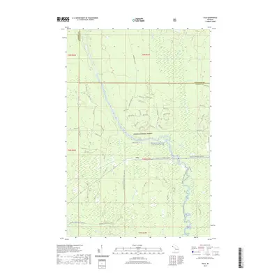
2019 Map of Tula
USGS Topo · Published 2019About this map
The Tula settlement area in the western Upper Peninsula is defined by its position within the Ottawa National Forest, where the landscape is intricately carved by the Presque Isle River. This waterway is designated as the Presque Isle Wild and Scenic River, featuring notable natural landmarks like Minnewawa Falls and Nimikon Falls. The drainage network is dense, with numerous tributaries such as Tula Cr, Jackson Cr, and Kandler Cr feeding into the main river channel.
Find a feature on this map
67 named features on this map. Tap any name to fly to it.
Don’t see what you’re looking for? This feature index may not catch every label — zoom into the map to look around manually.
Map Details
Editions of this 2019 Tula Map
This is the sole edition of this map. No revisions or reprints were ever made.
Other maps of this area

1955 · Marenisco
USGS Topo · 1:62,500

1955 · Marenisco
USGS Topo · 1:24,000

1955 · Wakefield
USGS Topo · 1:24,000

1955 · Wakefield
USGS Topo · 1:62,500

1955 · Wakefield NE
USGS Topo · 1:24,000

1956 · Bergland
USGS Topo · 1:62,500

1956 · Thomaston
USGS Topo · 1:62,500

1958 · Iron River
USGS Topo · 1:250,000

1960 · Iron River
USGS Topo · 1:250,000

1961 · Iron River
USGS Topo · 1:250,000