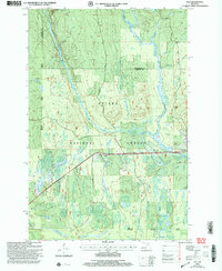
1999 Map of Tula
USGS Topo · Published 2004About this map
The Presque Isle River winds through this heavily forested section of the Upper Peninsula, carving a path through the Ottawa National Forest. This late-century survey captures a landscape defined by its waterways and timber-access routes, showing the prominent Minnewawa Falls and Nonesuch Falls along the river's course. Small settlements and transit points like Tula and Jack Spur are situated along the main transportation corridor, reflecting the area's history of logging and rail-linked industry. The map illustrates the transition from the Bessemer Bergland District to the surrounding wilderness, marked by a network of forest roads such as Tower Road and Underwood Road. Numerous small water bodies, including Bass Lake and Cherry Creek, drain the interior, while scattered Gravel Pits suggest ongoing resource extraction near the river valley.
Find a feature on this map
28 named features on this map. Tap any name to fly to it.
Don’t see what you’re looking for? This feature index may not catch every label — zoom into the map to look around manually.
Map Details
Editions of this 1999 Tula Map
This is the sole edition of this map. No revisions or reprints were ever made.
Other maps of this area

1955 · Marenisco
USGS Topo · 1:62,500

1955 · Marenisco
USGS Topo · 1:24,000

1955 · Wakefield
USGS Topo · 1:24,000

1955 · Wakefield
USGS Topo · 1:62,500

1955 · Wakefield NE
USGS Topo · 1:24,000

1956 · Bergland
USGS Topo · 1:62,500

1956 · Thomaston
USGS Topo · 1:62,500

1958 · Iron River
USGS Topo · 1:250,000

1960 · Iron River
USGS Topo · 1:250,000

1961 · Iron River
USGS Topo · 1:250,000