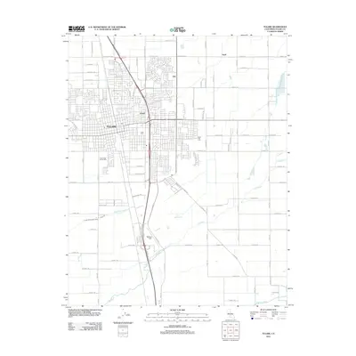
2012 Map of Tulare
USGS Topo · Published 2012About this map
Tulare serves as the central hub of this San Joaquin Valley landscape, where an extensive grid of agricultural avenues supports a productive irrigation network. The Tulare Irrigation Canal and watercourses like Elk Bayou and N Br Tule River provide the essential moisture for the surrounding fields, including the specialized Tulare High School Farm. The map documents the city's eastern expansion toward Elba and Swall, while Mefford Field and the Tulare Golf Links mark the transition from urban to rural use.
Find a feature on this map
87 named features on this map. Tap any name to fly to it.
Don’t see what you’re looking for? This feature index may not catch every label — zoom into the map to look around manually.
Map Details
Editions of this 2012 Tulare Map
This is the sole edition of this map. No revisions or reprints were ever made.
Other maps of this area

1925 · Tulare
USGS Topo · 1:31,680

1925 · Tipton
USGS Topo · 1:31,680

1926 · Goshen
USGS Topo · 1:31,680

1926 · Exeter
USGS Topo · 1:31,680

1927 · Cairns Corner
USGS Topo · 1:31,680

1927 · Lake View School
USGS Topo · 1:31,680

1927 · Paige
USGS Topo · 1:31,680

1927 · Visalia
USGS Topo · 1:31,680

1927 · Tulare
USGS Topo · 1:31,680

1928 · Tipton
USGS Topo · 1:31,680