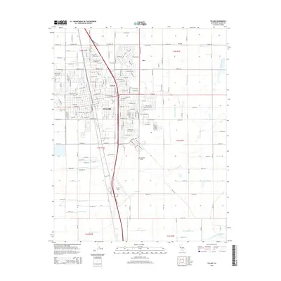
2015 Map of Tulare
USGS Topo · Published 2015About this map
Tulare anchors this part of the San Joaquin Valley, defined by a rigid grid of agricultural roads and a sophisticated network of irrigation infrastructure. The landscape is crisscrossed by essential water channels including the Tulare Canal, Tulare Irrigation Canal, and Bates Slough Ditch, reflecting the region's intensive water management. The Union Pacific railroad cuts a diagonal path through the city, passing near the Tulare Cem and the smaller settlements of Imhoff and Elba. To the south, Mefford Field serves as a regional aviation hub, while the natural drainage of Elk Bayou and the North Branch Tule River provide the underlying topography for this productive agricultural corridor. Small communities like Swall punctuate the grid, illustrating the transition between the urban center and the surrounding farmlands.
Find a feature on this map
108 named features on this map. Tap any name to fly to it.
Don’t see what you’re looking for? This feature index may not catch every label — zoom into the map to look around manually.
Map Details
Editions of this 2015 Tulare Map
This is the sole edition of this map. No revisions or reprints were ever made.
Other maps of this area

1925 · Tulare
USGS Topo · 1:31,680

1925 · Tipton
USGS Topo · 1:31,680

1926 · Goshen
USGS Topo · 1:31,680

1926 · Exeter
USGS Topo · 1:31,680

1927 · Cairns Corner
USGS Topo · 1:31,680

1927 · Lake View School
USGS Topo · 1:31,680

1927 · Paige
USGS Topo · 1:31,680

1927 · Visalia
USGS Topo · 1:31,680

1927 · Tulare
USGS Topo · 1:31,680

1928 · Tipton
USGS Topo · 1:31,680