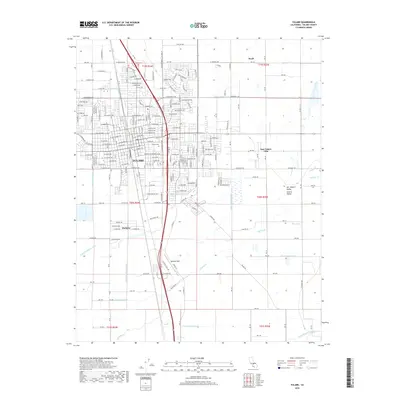
2018 Map of Tulare
USGS Topo · Published 2018About this map
The city of Tulare serves as a central hub within the San Joaquin Valley Central Valley, where an intricate grid of irrigation infrastructure supports the regional agricultural economy. This 2018 survey illustrates a complex water management network, featuring the Tulare Canal, Tulare Irrigation Canal, and numerous specialized channels like the Oakland Colony Ditch and Bates Slough Ditch. Transportation corridors are anchored by the Union Pacific railroad and the presence of Mefford Field to the south. Surrounding the urban center, smaller settlements and residential pockets such as Matheny, East Tulare Villa, and Swall are interspersed among the fields. The southern reaches of the quadrangle are defined by the winding course of Elk Bayou, which meanders through the landscape alongside the Tulare Cem, providing a detailed look at the interface between the growing city and the valley floor.
Find a feature on this map
112 named features on this map. Tap any name to fly to it.
Don’t see what you’re looking for? This feature index may not catch every label — zoom into the map to look around manually.
Map Details
Editions of this 2018 Tulare Map
This is the sole edition of this map. No revisions or reprints were ever made.
Other maps of this area

1925 · Tulare
USGS Topo · 1:31,680

1925 · Tipton
USGS Topo · 1:31,680

1926 · Goshen
USGS Topo · 1:31,680

1926 · Exeter
USGS Topo · 1:31,680

1927 · Cairns Corner
USGS Topo · 1:31,680

1927 · Lake View School
USGS Topo · 1:31,680

1927 · Paige
USGS Topo · 1:31,680

1927 · Visalia
USGS Topo · 1:31,680

1927 · Tulare
USGS Topo · 1:31,680

1928 · Tipton
USGS Topo · 1:31,680