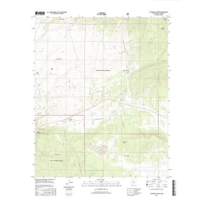
2017 Map of Tularosa Canyon
USGS Topo · Published 2017About this map
The Continental Divide winds through this high-altitude landscape in western New Mexico, where the Apache National Forest meets the Gila National Forest. This terrain is defined by its drainage systems and water sources, from the prominent Tularosa Canyon to smaller cuts like Barreras Canyon and Indio Canyon. The presence of numerous named water catchments, such as Lambing Camp Tank, Fence Tank, and Thomas Tank, indicates a landscape managed for livestock grazing within the national forests. In the northeast corner, the Mangas Mountains overlook a series of flats and canyons, including the Sand Flats and Sand Flat Canyon. Significant freshwater sources like Celso Spring and Lopez Spring provide vital points of interest for those studying the natural hydrology and land use patterns of Catron County in the early 21st century.
Find a feature on this map
33 named features on this map. Tap any name to fly to it.
Don’t see what you’re looking for? This feature index may not catch every label — zoom into the map to look around manually.
Map Details
Editions of this 2017 Tularosa Canyon Map
This is the sole edition of this map. No revisions or reprints were ever made.
Other maps of this area

1915 · Reserve
USGS Topo · 1:125,000

1918 · Pelona
USGS Topo · 1:125,000

1918 · Reserve
USGS Topo · 1:125,000

1954 · Clifton
USGS Topo · 1:250,000

1954 · Saint Johns
USGS Topo · 1:250,000

1957 · Clifton
USGS Topo · 1:250,000

1957 · Saint Johns
USGS Topo · 1:250,000

1958 · Clifton
USGS Topo · 1:250,000

1958 · Saint Johns
USGS Topo · 1:250,000

1962 · Clifton
USGS Topo · 1:250,000