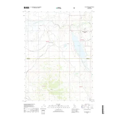
2018 Map of Tule Mountain
USGS Topo · Published 2018About this map
The Modoc Line Rail Trail winds through this high-elevation landscape, tracing a historic transportation corridor that once connected the remote corners of the region. Crossing the boundary between Modoc and Lassen counties, the map highlights the transition from the irrigated ranchlands along the South Fork Pit River to the timbered slopes of the Modoc National Forest. This 2018 survey reveals a terrain defined by significant water management features, including the expansive West Valley Reservoir and Smith Reservoir, which serve as vital resources in this arid environment.
Find a feature on this map
26 named features on this map. Tap any name to fly to it.
Don’t see what you’re looking for? This feature index may not catch every label — zoom into the map to look around manually.
Map Details
Editions of this 2018 Tule Mountain Map
This is the sole edition of this map. No revisions or reprints were ever made.
Other maps of this area

1886 · Alturas
USGS Topo · 1:250,000

1892 · Alturas
USGS Topo · 1:250,000

1954 · Alturas
USGS Topo · 1:250,000

1958 · Alturas
USGS Topo · 1:250,000

1961 · Alturas
USGS Topo · 1:62,500

1962 · Alturas
USGS Topo · 1:250,000

1962 · Tule Mountain
USGS Topo · 1:24,000
1962 · Madeline
USGS Topo · 1:24,000
1962 · Cold Spring Mtn
USGS Topo · 1:24,000

1962 · Jess Valley
USGS Topo · 1:24,000