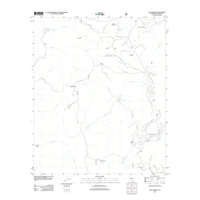
2012 Map of Tule Springs
USGS Topo · Published 2012About this map
Eagle Peak and Sunshine Mountain anchor the high terrain of this San Diego County quadrangle, where deep canyons and drainage basins define the rural landscape. In the northwest, the San Diego River receives the waters of Cedar Cr at the site of Cedar Creek Falls. The area is characterized by several established ranching properties and small settlements, including Rancho Alegria, Sherilton Valley Ranch, and the Echo Dell Ranch.
Find a feature on this map
38 named features on this map. Tap any name to fly to it.
Don’t see what you’re looking for? This feature index may not catch every label — zoom into the map to look around manually.
Map Details
Editions of this 2012 Tule Springs Map
This is the sole edition of this map. No revisions or reprints were ever made.
Other maps of this area

1893 · El Cajon
USGS Topo · 1:62,500

1901 · Elcajon
USGS Topo · 1:62,500

1903 · Cuyamaca
USGS Topo · 1:125,000

1903 · Elcajon
USGS Topo · 1:62,500

1903 · Ramona
USGS Topo · 1:125,000

1904 · Southern California Sheet No. 2
USGS Topo · 1:250,000

1939 · El Cajon
USGS Topo · 1:62,500

1939 · Santa Ysabel
USGS Topo · 1:62,500

1942 · El Cajon
USGS Topo · 1:62,500

1942 · Ramona
USGS Topo · 1:62,500