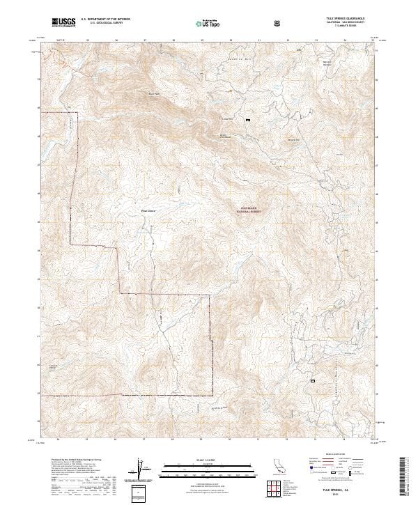
2021 Map of Tule Springs
USGS Topo · Published 2021About this map
The Cleveland National Forest dominates this section of the Cuyamaca Mountains, where the landscape is defined by steep drainage basins and prominent granite summits. The western edge is carved by the San Diego River, featuring the drop at Cedar Creek Falls and the trailhead leading through the San Diego River Gorge Trl. This area is characterized by scattered springs and meadows that provided vital water sources for early settlers and travelers, such as Anahuac Spring, Wildcat Spring, and the high-altitude Marston Meadow. The map documents a network of named peaks and valleys, including Sunshine Mtn and Eagle Peak, alongside localized points of interest like the Devils Punchbowl and the small settlement at Pine Grove. From the depths of Poverty Gulch to the heights of Mineral Hill, the terrain reflects a transition between the coastal foothills and the higher mountain interior.
Find a feature on this map
41 named features on this map. Tap any name to fly to it.
Don’t see what you’re looking for? This feature index may not catch every label — zoom into the map to look around manually.
Map Details
Editions of this 2021 Tule Springs Map
This is the sole edition of this map. No revisions or reprints were ever made.
Other maps of this area

1893 · El Cajon
USGS Topo · 1:62,500

1901 · Elcajon
USGS Topo · 1:62,500

1903 · Cuyamaca
USGS Topo · 1:125,000

1903 · Elcajon
USGS Topo · 1:62,500

1903 · Ramona
USGS Topo · 1:125,000

1904 · Southern California Sheet No. 2
USGS Topo · 1:250,000

1939 · El Cajon
USGS Topo · 1:62,500

1939 · Santa Ysabel
USGS Topo · 1:62,500

1942 · El Cajon
USGS Topo · 1:62,500

1942 · Ramona
USGS Topo · 1:62,500