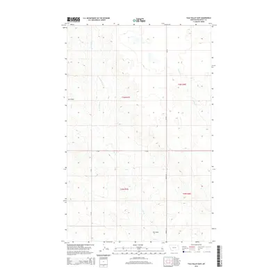
2014 Map of Tule Valley East
USGS Topo · Published 2014About this map
Tule Valley characterizes this portion of Roosevelt County, where the high plains of northeastern Montana are defined by a complex network of intermittent drainage systems. The landscape is dominated by the seasonal flow of Tule Cr and its northern tributary, N Fork Tule Cr, which carve through the terrain as they move toward the Missouri River watershed to the south. In the eastern portion of the quadrangle, Chelsea Cr follows a parallel course, tracing the natural contours of the undulating prairie.
Find a feature on this map
10 named features on this map. Tap any name to fly to it.
Don’t see what you’re looking for? This feature index may not catch every label — zoom into the map to look around manually.
Map Details
Editions of this 2014 Tule Valley East Map
This is the sole edition of this map. No revisions or reprints were ever made.
Other maps of this area

1910 · Cuskers
USGS Topo · 1:62,500

1912 · Chelsea
USGS Topo · 1:62,500

1915 · Tule Valley
USGS Topo · 1:62,500

1915 · Cuskers
USGS Topo · 1:62,500

1916 · Wolf Point
USGS Topo · 1:62,500

1954 · Wolf Point
USGS Topo · 1:250,000

1958 · Wolf Point
USGS Topo · 1:250,000

1972 · Chelsea NW
USGS Topo · 1:24,000
1972 · Wolf Point NE
USGS Topo · 1:24,000
1972 · Wolf Point NW
USGS Topo · 1:24,000