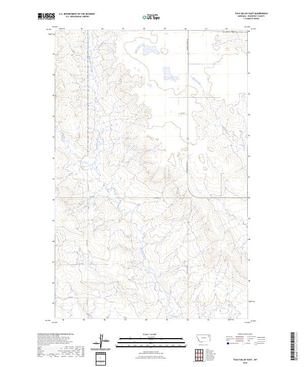
2024 Map of Tule Valley East
USGS Topo · Published 2024About this map
North Fork Tule Creek and its southern counterpart, Tule Creek, define the drainage patterns of this Roosevelt County landscape. The terrain is characterized by the complex dissection of the northern plains, where these waterways have carved distinct valleys through the high ground. To the northeast, Chelsea Creek cuts across the township boundaries of t30n r48e and t29n r48e, providing additional drainage for the upland areas.
Find a feature on this map
13 named features on this map. Tap any name to fly to it.
Don’t see what you’re looking for? This feature index may not catch every label — zoom into the map to look around manually.
Map Details
Editions of this 2024 Tule Valley East Map
This is the sole edition of this map. No revisions or reprints were ever made.
Other maps of this area

1910 · Cuskers
USGS Topo · 1:62,500

1912 · Chelsea
USGS Topo · 1:62,500

1915 · Tule Valley
USGS Topo · 1:62,500

1915 · Cuskers
USGS Topo · 1:62,500

1916 · Wolf Point
USGS Topo · 1:62,500

1954 · Wolf Point
USGS Topo · 1:250,000

1958 · Wolf Point
USGS Topo · 1:250,000

1972 · Chelsea NW
USGS Topo · 1:24,000
1972 · Wolf Point NE
USGS Topo · 1:24,000
1972 · Wolf Point NW
USGS Topo · 1:24,000