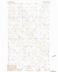
1983 Map of Tule Valley East
USGS Topo · Published 1983About this map
Tule Valley defines the topography of this Roosevelt County landscape, where the North Fork Tule Creek and Chelsea Creek carve through the high plains. This 1983 provisional survey captures the area within the Fort Peck Indian Reservation before modern developments, showing a region defined primarily by its drainage patterns and section lines. The absence of major settlements highlights the rural nature of this portion of Montana during the early 1980s, where human activity is sparsely represented by a single Gravel Pit and a network of unimproved roads and trails. The map provides a detailed view of the township boundaries between T30N and T29N, illustrating the systematic land division that governed this part of the state.
Find a feature on this map
6 named features on this map. Tap any name to fly to it.
Don’t see what you’re looking for? This feature index may not catch every label — zoom into the map to look around manually.
Map Details
Editions of this 1983 Tule Valley East Map
This is the sole edition of this map. No revisions or reprints were ever made.
Other maps of this area

1910 · Cuskers
USGS Topo · 1:62,500

1912 · Chelsea
USGS Topo · 1:62,500

1915 · Tule Valley
USGS Topo · 1:62,500

1915 · Cuskers
USGS Topo · 1:62,500

1916 · Wolf Point
USGS Topo · 1:62,500

1954 · Wolf Point
USGS Topo · 1:250,000

1958 · Wolf Point
USGS Topo · 1:250,000

1972 · Chelsea NW
USGS Topo · 1:24,000
1972 · Wolf Point NE
USGS Topo · 1:24,000
1972 · Wolf Point NW
USGS Topo · 1:24,000