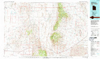
1981 Map of Tule Valley
USGS Topo · Published 1992About this map
High desert basins and steep carbonate ridges define this section of West-Central Utah, where the Tule Valley sits between the massive House Range and the Confusion Range. In the early 1980s, the landscape remained sparsely populated, anchored by small settlements like Gandy and Eskdale in the west along Snake Valley. The map reveals a history of remote resource extraction, with the Rattlesnake Mine and Sunbeam Mine tucked into the slopes of the mountains, while numerous passes such as Skull Rock Pass and Dome Canyon Pass provided the only viable routes through the north-south trending ridges.
Find a feature on this map
88 named features on this map. Tap any name to fly to it.
Don’t see what you’re looking for? This feature index may not catch every label — zoom into the map to look around manually.
Map Details
Editions of this 1981 Tule Valley Map
3 editions found
Other maps of this area

1885 · Beaver
USGS Topo · 1:250,000

1885 · Sevier Desert
USGS Topo · 1:250,000

1908 · Fish Springs
USGS Topo · 1:250,000

1910 · Fish Springs
USGS Topo · 1:250,000

1949 · Garrison
USGS Topo · 1:62,500

1951 · Garrison
USGS Topo · 1:62,500

1953 · Topaz Mtn
USGS Topo · 1:62,500

1953 · Richfield
USGS Topo · 1:250,000

1953 · Delta
USGS Topo · 1:250,000

1956 · Lund
USGS Topo · 1:250,000